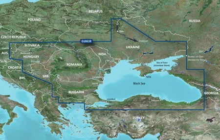
Garmin BlueChart G3 Balaton, Duna, Fekete-/Azovi-tenger (010-C1064-20)

Rövid termékleírás
Garmin hajózási folyami és tengeri térkép
(Nettó ár: 51.890,- Ft) Bruttó ár: 65.900,- Ft
Garmin hajózási folyami és tengeri térkép
(Nettó ár: 51.890,- Ft) Bruttó ár: 65.900,- Ft
Kosárba teszem
Ezt a terméket ingyenesen házhozszállítjuk!
Termékleírás

Detailed coverage of the Dardanelles, the Sea of Mamara, the Bosporus Strait, the Black Sea, the Dnieper River to the Belarus/Ukrainian border, the Bug River to Nikolayev, the Kuban River to Krasnodar, the Danube River from Vienna to it's delta, the Sava River, the Danube - Black Sea Canal, Lake Balaton, Lake Ferto, the Tisa River to Lake Tisza and the Sea of Azov. Detailed coverage includes Varna, Constanta, Odessa, Nikolayev, Sevastopol', and Mariupol, Taganrog, Temryuk, Novorossiysk, and Batumi, Hopa, Samsun, Eregli, Istanbul and Canakkale.
Kapcsolódó termékek


